Life-threatening flooding pummels western Kentucky, submerging homes and stranding residents
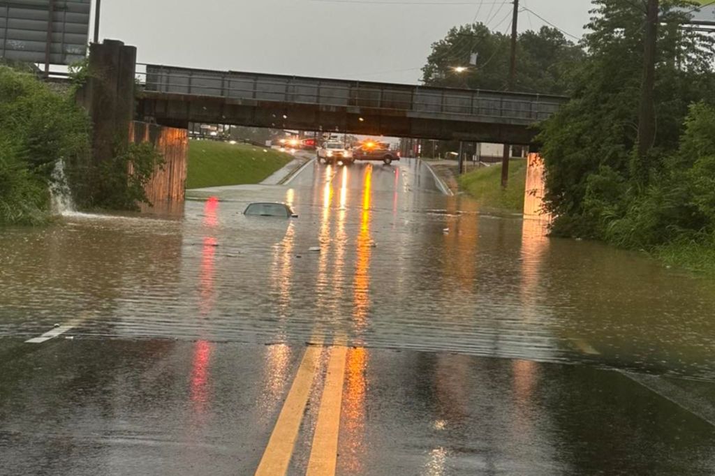
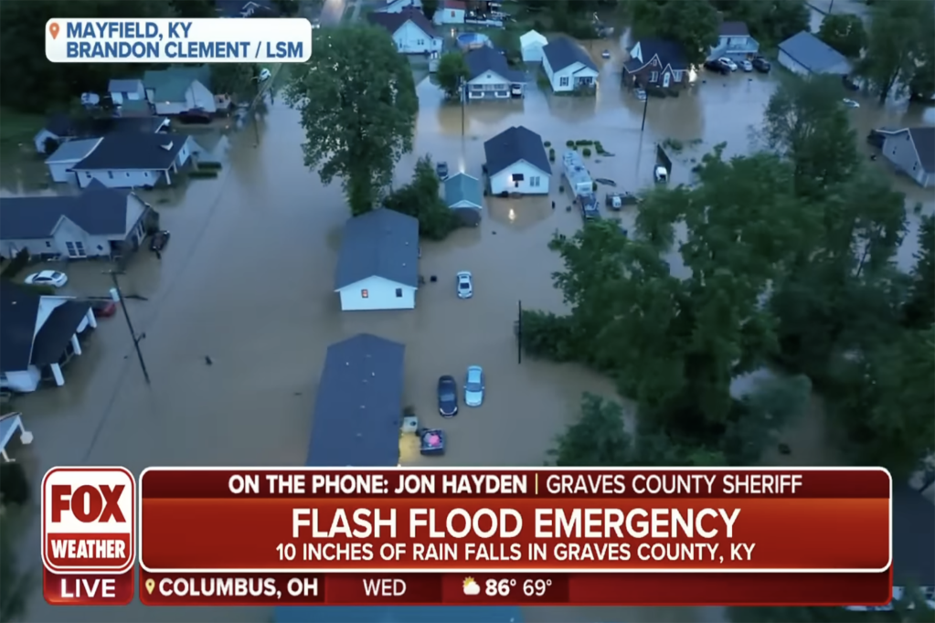
Historic amounts of rainfall prompted a Flash Flood Emergency in western Kentucky, including the town of Mayfield, Wednesday as waves of thunderstorms pushed through the region.
According to the National Weather Service, 11.28 inches of rain has fallen in the past 24 hours near Mayfield in Graves County, and will likely set a new 24-hour rainfall record in the Bluegrass State.
The previous record was 10.48 inches in Louisville on March 1, 1997.
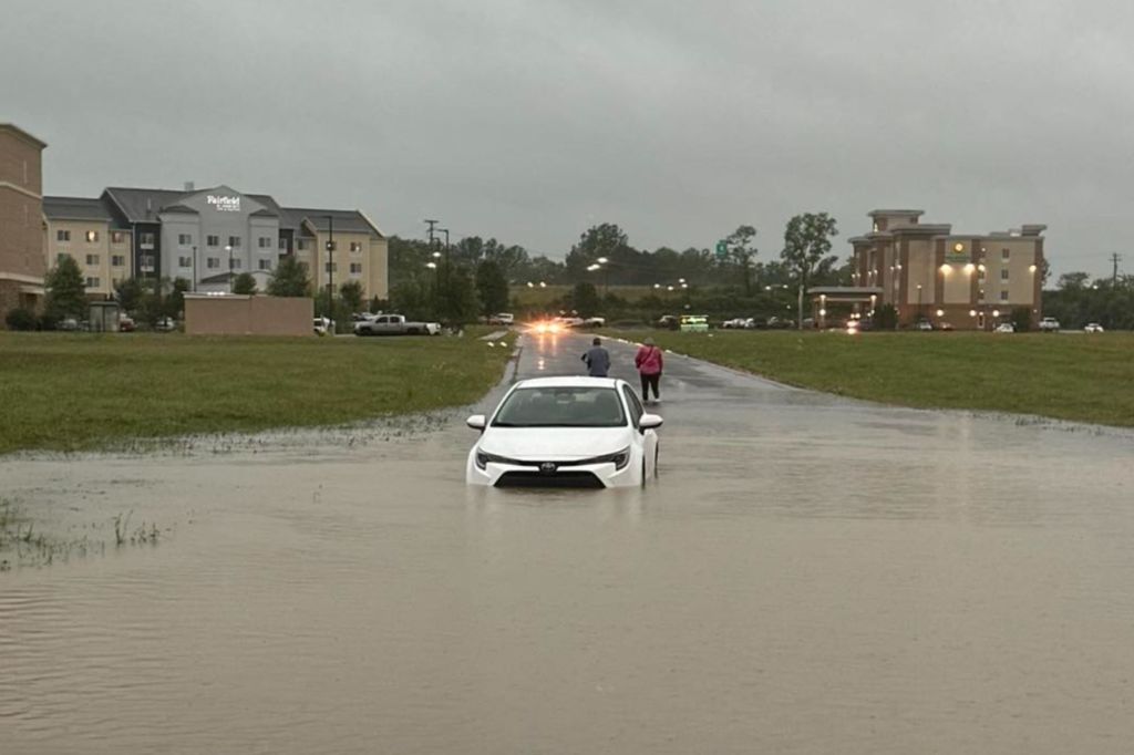
The rain swamped roads and prompted several water rescues.
Many homes in Mayfield and Wingo were surrounded by water.
“Please pray for Mayfield and areas of western Kentucky impacted by significant flooding from last night’s storms,” Kentucky Gov. Andy Beshear said in a tweet before declaring a state of emergency. “We’re working to assess the damage and respond. Just like every challenge we’ve faced, we will be there for all those affected. We will get through this together.”
Mayfield Fire Chief Jeremy Creason told FOX Weather that the flooding is in areas that are prone to flooding – mostly between four city blocks.
Firefighters responded to two 911 calls from people trapped in their homes in this area.
Residents were told to shelter in place until road became passable for emergency personnel to reach them.

Some places received up to 4 feet of water.
“The rain in this area was just horrendous,” storm chaser Brandon Clement told FOX Weather. “The rain was so heavy it was like whiteout. It just all overwhelmed all infrastructure in place.”
Clement has been surveying the flooding damage in the region and found widespread impacts.
“In Mayfield, there’s quite a few structures flooded along a creek that runs through town,” Clement said. “It’s not a good situation.”
In nearby Paducah, storm chaser Jonathan Petramala said it was “absolutely chaos.”
Wednesday was the second-wettest day of all-time for the city, with 6.73 inches of rain that had fallen Wednesday.

“All over downtown Paducah, just numerous roadways covered in water,” he told FOX Weather. “You have trees getting blown down, snapped like twigs. You have power lines, and you have transformers bursting as well. It’s a very dangerous morning in western Kentucky.”
Footage captured by Angela Belt Newcom outside her home in Hickory showed just how fast the water rose in Graves County.
Kentucky’s governor issued a State of Emergency due to the severe weather and said crews were monitoring the threat for additional rain chances.

More thunderstorms expected after a brief lull Wednesday afternoon
A lull in the storms allowed first responders to participate in rescue operations on Wednesday, but more thunderstorms were expected in the Ohio Valley on Thursday.
A cold front has stalled to the north of the region, pinning deep tropical-infused moisture against that front.
Meanwhile, rounds of thunderstorms along the frontal boundary are tapping into that moisture, dropping intense amounts of rain.
Forecast models show an additional 1-2″ of rainfall was possible through the remaining days of the workweek but locally heavy amounts are likely in the stronger storms.
Mayfield floods 18 months after deadly EF-4 tornado
For those in Mayfield, the floods are a painful reminder of the power of Mother Nature.
The town is still recovering from a devastating EF-4 tornado that tore through the region in Dec. 2021, leaving more than 80 dead and over 1,000 homes lost.
The twister spanned over 165 miles over 19 counties in just three hours and is now known as the deadliest and longest-tracked tornado in Kentucky’s history.
Mayfield Mayor Kathy Stewart O’Nan told FOX Weather last December the tornado had damaged or destroyed more than 60 businesses in the town of just 10,000 people.
Read the full article Here


