US to see warmer temps following Christmas blizzard
As the nation powers through a deadly arctic outbreak that brought sub-zero readings to the northern tier of the country and a hard freeze, not seen in several years, to the South, frigid residents might be clamoring for a break.
It appears Mother Nature will oblige.
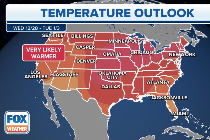
NOAA’s 8-14 day temperature outlook issued Monday for the final days of 2022 shows a colossal pattern flip that will take the entire Lower 48 states out of the ice box and warm things up a bit.
Forecasters are highly confident of above-average temperatures between Dec. 28 and Jan. 3 across much of the West, the western Plains, and the Northeast, with slightly less confidence — but still a rather robust signal — for above-average temperatures across the Southwest and far Southeast.
That doesn’t mean breaking out the shorts, but it could mean, for example, high temperatures in the Northern Plains reaching near or above freezing, when average highs are in the low-mid 20s. Or put another way, a welcome sight to see a ’25’ or ’30’ without a minus sign in front of it.
The Great Lakes area, fresh off its blizzard this week, could rebound into the 40s and 50s, with New England seeing highs climbing solidly back into the 50s.
Even Florida, which is forecast to be coming off its coldest Christmas in over 30 years, will likely warm back into more Florida-like temperatures that average in the upper 60s and 70s this time of year. Parts of Texas look to climb back into the 70s too.
The 49th State will feel some relative warmth – at least in the Alaska Panhandle, where after temperatures have been flirting with zero this week, they should claw back into the 30s next week. Western Alaska is the lone spot in America predicted to have below-average temperatures to ring in 2023.
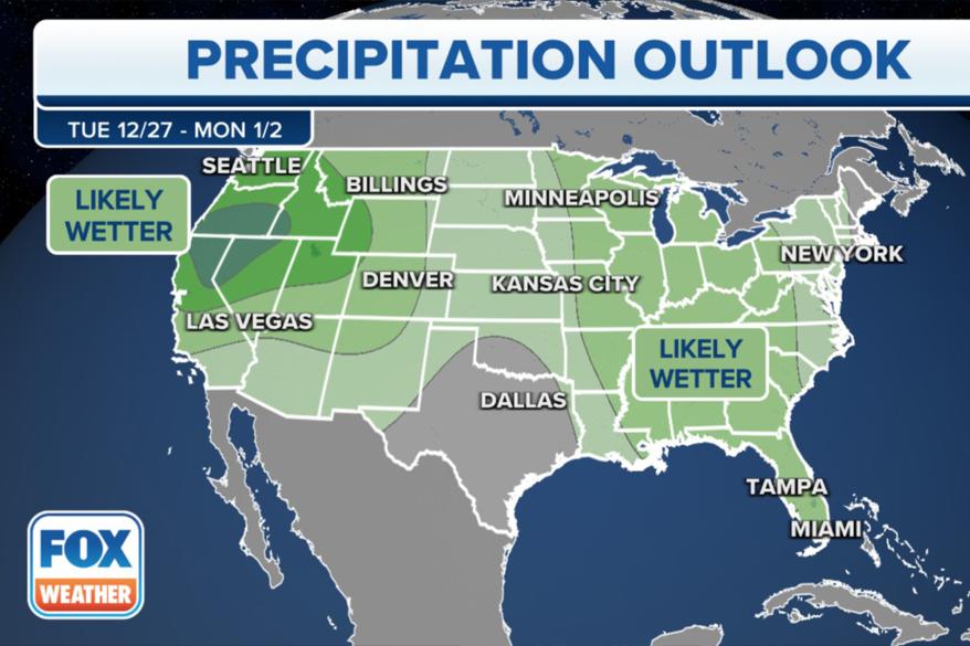
NOAA’s precipitation outlook doesn’t indicate that it will be a “dry heat,” as confidence is leaning toward a coinciding above-average period of precipitation, particularly in the Northwest.
Read the full article Here


