2 storms traversing US this week expected to bring severe weather
The FOX Forecast Center is keeping its eyes on two storm systems that are set to bring severe weather, heavy snow and flooding rains to various parts of the country this week.
The storms will be moving ashore in two different locations in the West – the first is moving into California starting on Sunday, and the second will follow on its heels a few days later in the Pacific Northwest.
But even though these two storms are originating in different regions, the back-to-back nature will significantly impact the US because of the double hit.
Storm #1
A storm system is expected to bring rain to Southern California and snow to the Four Corner region Sunday and Monday while a second storm system pushes into the Pacific Northwest bringing rain to lower elevations and heavy snow to the Cascades and the Coast Range in Oregon.
The first storm system isn’t much to look at now, but some showers are possible across Southern California on Sunday.
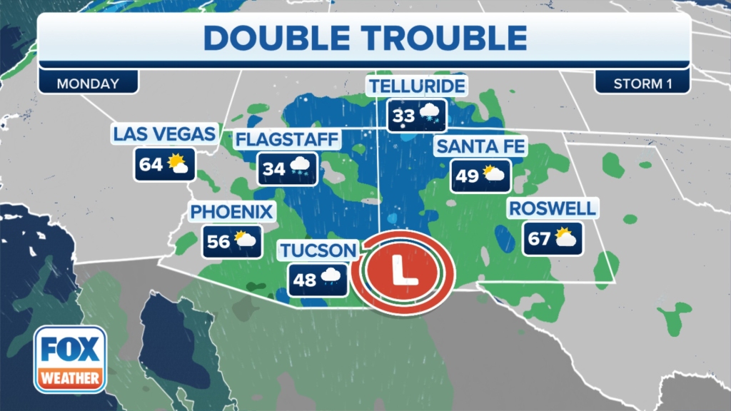
On Monday, the FOX Forecast Center expects the storm system to continue pushing off to the east, bringing rain and mountain snow to the Four Corners region.
This also includes the city of Phoenix, which may lead to flight disruptions for people trying to leave town after Super Bowl LVII.
Generally, under a half-inch of rain will fall across parts of Arizona and New Mexico, with snow levels remaining above 4,000 feet, and only light accumulations are expected.
About 6 inches or less of snow will fall in Arizona, while the best chance for a foot of snow will be in the highest elevations of New Mexico and southern Colorado.
The storm will then push into the Plains on Tuesday, mainly bringing rain and eventually some snow before it washes away on Wednesday.
Up to an inch of rain will be possible from Texas to Michigan, including the drought-stricken areas of Oklahoma and Kansas.
The severe weather threat looks low at this point, but some severe thunderstorms are possible across the lower Mississippi Valley.
When the storm reaches the Upper Midwest, it will encounter enough cold air to allow for snow to break out Tuesday evening into Wednesday across northern Minnesota and the eastern Dakotas.
Storm #2
“That storm, number one, will likely wrap up as we head into Wednesday, but we will have to watch for storm number two that starts to work its way, moving right into the same path as storm number one across the Four Corners states offering at this point more snow for parts of the West from really Idaho down to Arizona and over toward New Mexico,” FOX weather meteorologist Kiyana Lewis said.
Lewis said that the storm system will tap into more energy as it heads east, raising the severe weather threat.
“(The storm) is bringing in more moisture from the Gulf (of Mexico), adding to the opportunity for more severe weather as we head into the middle of the week,” Lewis said.
As of Sunday, the severe weather threat includes areas of East Texas through the lower Mississippi Valley and into the Kentucky Valley.

However, the higher risk for severe thunderstorms will be from the Dallas-Fort Worth Metroplex east into Shreveport, Louisiana, Little Rock, Arkansas and Memphis, Tennessee.
The severe weather threat will shift on Thursday and will include millions of Americans from the Ohio Valley and Great Lakes region south through the Kentucky and Mississippi valleys into parts of the Southeast and along the Gulf Coast.
The storms Wednesday and Thursday will be capable of producing damaging wind gusts, large hail, tornadoes and heavy rainfall. As much as 3 inches of rain could soak parts of the South from the combination of multiple storm systems next week.
It’s possible the exact timing and locations at risk for severe weather and heavy snow next week could shift. Be sure to check back with FOX Weather for updates in the days ahead as the forecast details for the pair of storms come into better focus.

The great temperature divide
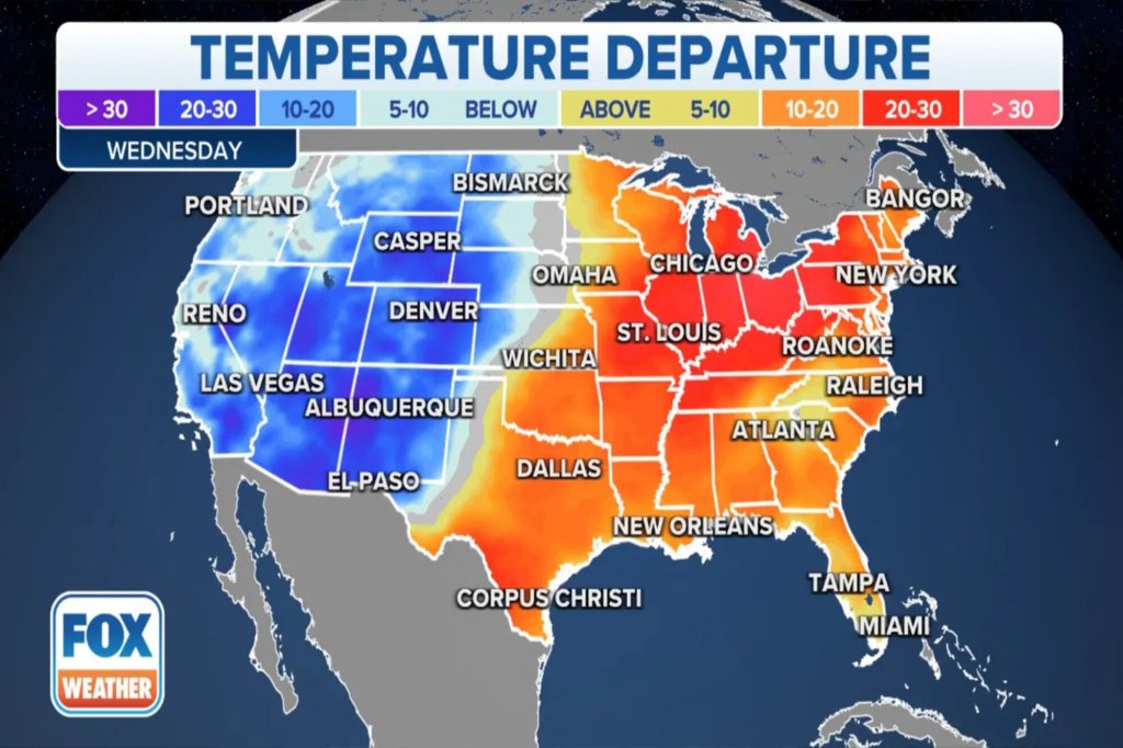
East of the frontal boundary, temperatures will start the week well above average.
As warm air moves into the eastern US, it will cause temperatures to rise into the upper 60s to lower 70s as far to the north as the Ohio Valley.
The clash between the warm air will help trigger showers and thunderstorms that will move across much of the eastern US midweek.
Temperatures behind the cold front are expected to drop by at least 10-20 degrees and will remind residents that winter is still underway.
Read the full article Here


