April cooldown brings below-average temperatures across US this week
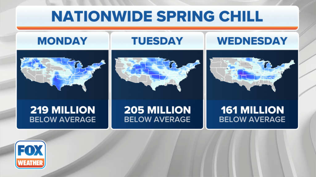
A cold front has wiped away recent warmth in the East as a plunge of cooler air sweeps across the central, southern and eastern US in April’s final week.
The cooler air arrived in the Midwest over the weekend and will now infiltrate the Southeast and Northeast as we begin the workweek.
That means high temperatures will likely hold in the 40s and lower to mid-50s across the Midwest, with 50s and lower 60s expected in the Northeast and mid-Atlantic and lower to mid-60s in the South from the southern Plains to the Tennessee Valley.
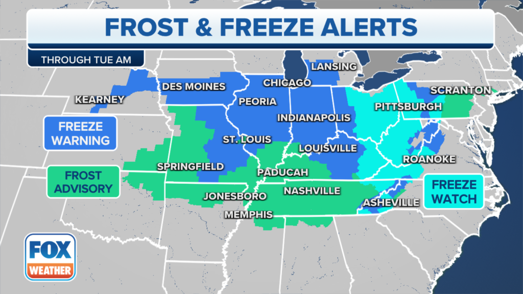
Frost, freeze alerts issued for over 67 million people
Frost Advisories and Freeze Watches and Warnings have been issued for more than 67 million people across portions of the Midwest, Ohio Valley, mid-Atlantic, Appalachians and Ozarks.
If you live in an area covered by these freeze alerts, cover up or bring any unprotected plants indoors to avoid potential damage to sensitive vegetation.
Cold records could be in jeopardy
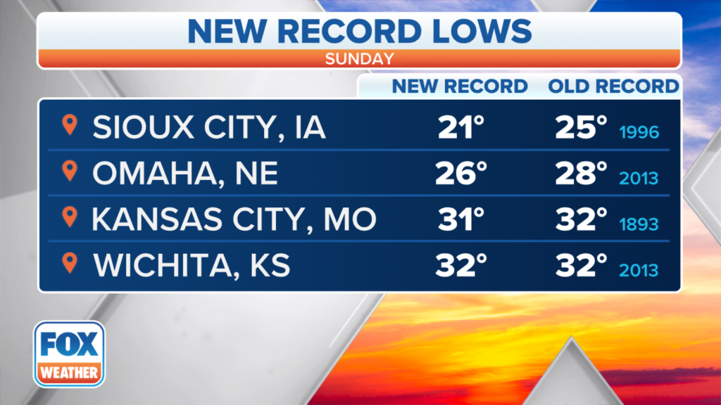
Record lows were already set Sunday morning in several cities across the Plains and Midwest, including Sioux City in Iowa (21 degrees), Omaha in Nebraska (26 degrees), Kansas City in Missouri (31 degrees) and Wichita in Kansas (32 degrees – tie). Indianapolis then tied its daily record low of 28 degrees on Monday morning.

Additional record lows will likely be tied or broken early this week.
On Tuesday morning, Asheville in North Carolina (32 degrees), Bristol in Tennessee (31 degrees) and Parkersburg in West Virginia (31 degrees) will each make a run at their daily record low.
How long will the April cooldown last?
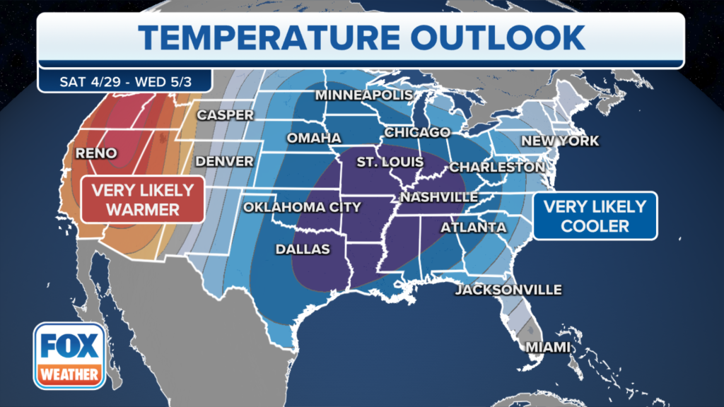
Long-range outlooks from NOAA’s Climate Prediction Center suggest this pattern of cooler-than-average temperatures will likely persist through the end of April and perhaps linger into the beginning of May.


However, portions of the West will finally turn warmer than average this week and into next week.
Read the full article Here


