Franklin intensifies to Category 1 hurricane, dangerous surf expected for East Coast
The Atlantic Ocean tropical storm Franklin strengthened to a hurricane on Saturday and is forecast to cause dangerous surf conditions up and down the East Coast early next week — although it is not expected to make landfall.
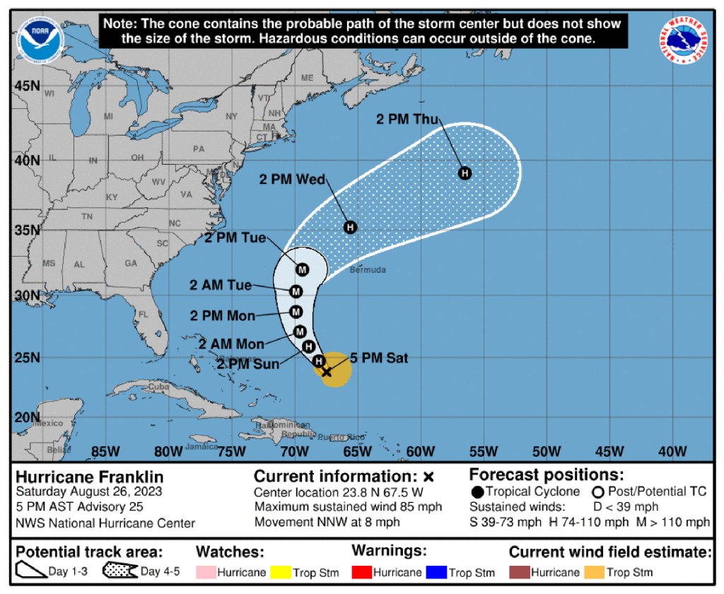
The storm is expected to rev up to a major Category 3 storm by Monday when it passes between the US Coast and Bermuda before turning eastward and petering out in the middle of the Atlantic, according to Fox Weather.
“This is not going to be a landfall for us,” said Fox meteorologist Britta Merwin. “We have a series of troughs coming off the East Coast and that’s going to be our protector. You don’t have to worry about this making landfall on the East Coast, but we could see some rough surf conditions.”
By Wednesday morning, waves off of North Carolina could be between 9 and 12 feet high, Merwin said.

Dangerous rip currents also anticipated along the east coast throughout the week. The Atlantic coast of Canada could also see impact from the storm.
“Thankfully, the strongest waves and the biggest waves are going to be out of here by the time we get to Labor Day weekend,” she said. “But if we have this pass too close, and we have some beach erosion ahead of the Labor Day weekend holiday, we could see some minor implications there.”
Franklin is steadily moving northwest at around 8 miles per hour with reported wind gusts of 85 miles per hour.
Winds are expected to intensify to gusts of up to 120 miles per hour on Monday and Tuesday before it continues north into colder water.
Read the full article Here


