
Caribbean tropical disturbance could develop into storm this weekend
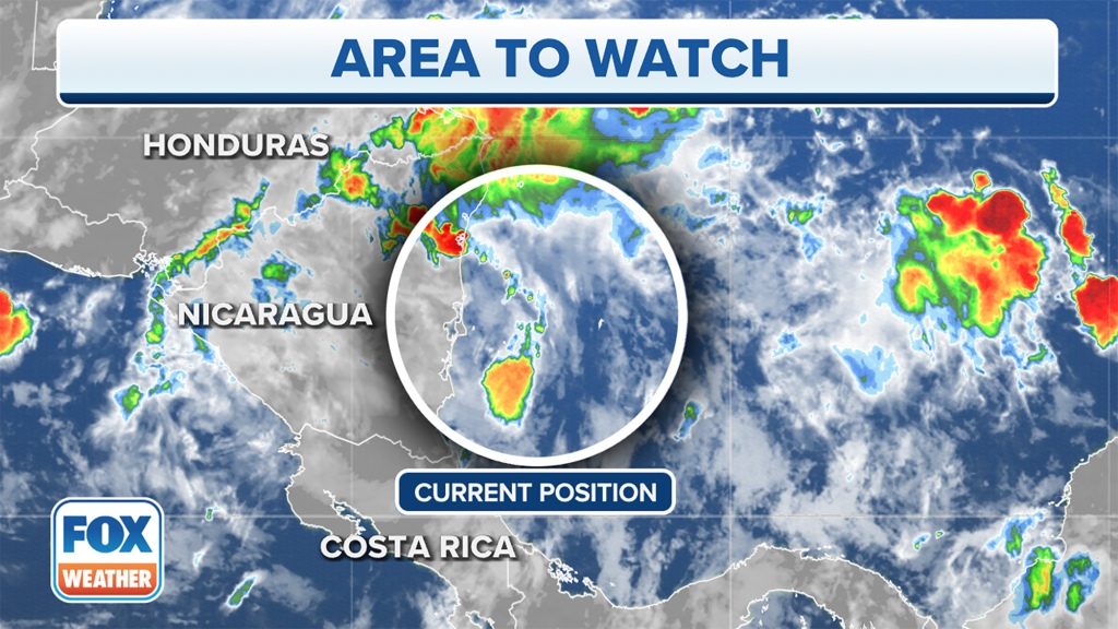
A tropical disturbance over the southwestern Caribbean Sea has grabbed the attention of the National Hurricane Center. It is being monitored for possible tropical development as it moves toward the southwestern Gulf of Mexico.
Any development will be slow to occur over the next few days, so this is nothing to be overly concerned about right now. That’s because the tropical disturbance will first move over land as it slides across parts of Central America and southern Mexico.
By Friday, however, the tropical disturbance will emerge over the Bay of Campeche in the southwestern Gulf of Mexico. That’s when an area of low pressure could form.
The NHC said this low-pressure system would then have the potential to develop into a tropical depression or tropical storm as it drifts northwest over the southwestern Gulf through the weekend.
“The concern is, as it starts to move into these warmer waters off in the southern Gulf, over the next five days — really at the end of that five-day period — we do have a potential of maybe seeing some development come together,” said FOX Weather meteorologist Jane Minar. “We certainly do have the water temperature to support it.”
Sea surface temperatures in the southwestern Gulf of Mexico are in the mid-80s, which is more than sufficient to support the development of a tropical depression or tropical storm. Typically, a water temperature of 80 degrees or higher is needed for tropical development.
According to the NHC, the odds of tropical development are low, but regardless of what this system is called — a tropical depression, tropical storm or simply an area of low pressure — rain chances will increase later Friday and into Saturday as it approaches the coast of Deep South Texas.
The next Atlantic system to become a tropical storm with winds of at least 40 mph will earn the name Danielle.
Read the full article Here
