Drenching rains could create travel headaches ahead of Memorial Day
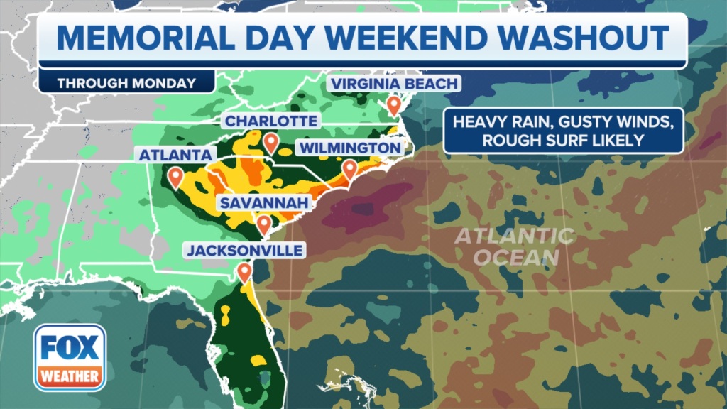
Heavy rain, gusty winds and rough surf are expected for parts of the East Coast for the Memorial Day weekend, potentially ruining travel plans for the millions vacationing during the unofficial start to summer.
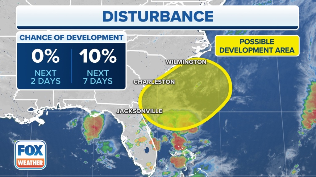
The FOX Forecast Center is tracking a complex weather scenario off the Eastern Seaboard, which could lead to a tropical disturbance developing over the western Atlantic that causes a holiday weekend washout for parts of the Carolinas and the Southeast coast.
The National Hurricane Center (NHC) said in a Tropical Weather Outlook on Wednesday afternoon there is only a 10% chance that the storm could become a subtropical or tropical cyclone because it is “forecast to remain frontal while moving generally northward and inland over the Carolinas this weekend.”
To become tropical, the system would have to lose its cold and warm fronts and develop a well-defined center of circulation, which the NHC said appears unlikely.
“Places like Atlanta … are going to have to focus on this just because of the changes and also the models kind of coming together on this forecast story,” FOX Weather meteorologist Britta Merwin said. “Looks like a lot of folks between Georgia, South Carolina and North Carolina will need indoor options for Memorial Day weekend.”
Computer forecast models show a cold front that has stalled near Florida this week could interact with spin developing in the upper levels of the atmosphere.

No matter whether the coastal low is tropical in formation, some Florida communities are in store for several inches of rainfall over the next few days.
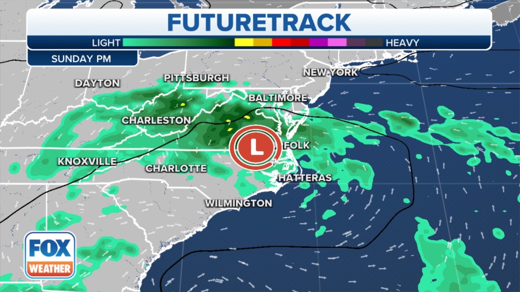
The low-pressure system is then expected to curve westward into the Carolinas over the Memorial Day weekend.
Periods of heavy rain, rough surf and gusty winds are likely along parts of the Southeast coast, dampening some holiday weekend beach plans.

“These forecasts are going to wobble just a little bit here over the next 24 hours,” FOX Weather meteorologist Jason Frazer said. “But we’re really confident that the Carolinas are going to be getting rain. You’re also going to be getting hit with some decent amount of wind.”
42.3 million Americans will travel this weekend
The American Automobile Association projects 2.7 million more people will travel this year compared to last – a rise of 2.7% and a sign of what’s to come in the months ahead.
More than 42.3 million Americans will travel 50 miles or more from home this weekend.
“This is expected to be the third-busiest Memorial Day weekend since 2000 when AAA started tracking holiday travel,” said Paula Twidale, senior vice president of AAA Travel. “More Americans are planning trips and booking them earlier, despite inflation. This summer travel season could be one for the record books, especially at airports.”

A large ridge of high pressure over the Northeast is going to deliver the saving grace this weekend for those there, keeping the forecast dry north of Washington, D.C.
“It’s also going to really hammer this coastal low right into the Carolinas,” Merwin said. “A double-edged sword here where we have some big impacts for the Carolinas because of that blocking high to the north.
It just can’t move to the north, and so this area of low pressure only has one option that’s to drive it right into coastal areas of South Carolina and North Carolina.”
Additionally, the combination of gusty winds and rough seas will likely lead to an enhanced threat from rip currents that could stretch from the Carolinas through the Sunshine State.
Read the full article Here


