
Fast-moving storm spurs potential Southern California tornado
LOS ANGELES – Just one day after a deadly atmospheric river storm moved out of California and made its way to the east and impacted the Las Vegas area, where preparations are underway for Super Bowl LVIII, another storm swept through the Golden State with additional rain, mountain snow and even a possible tornado.
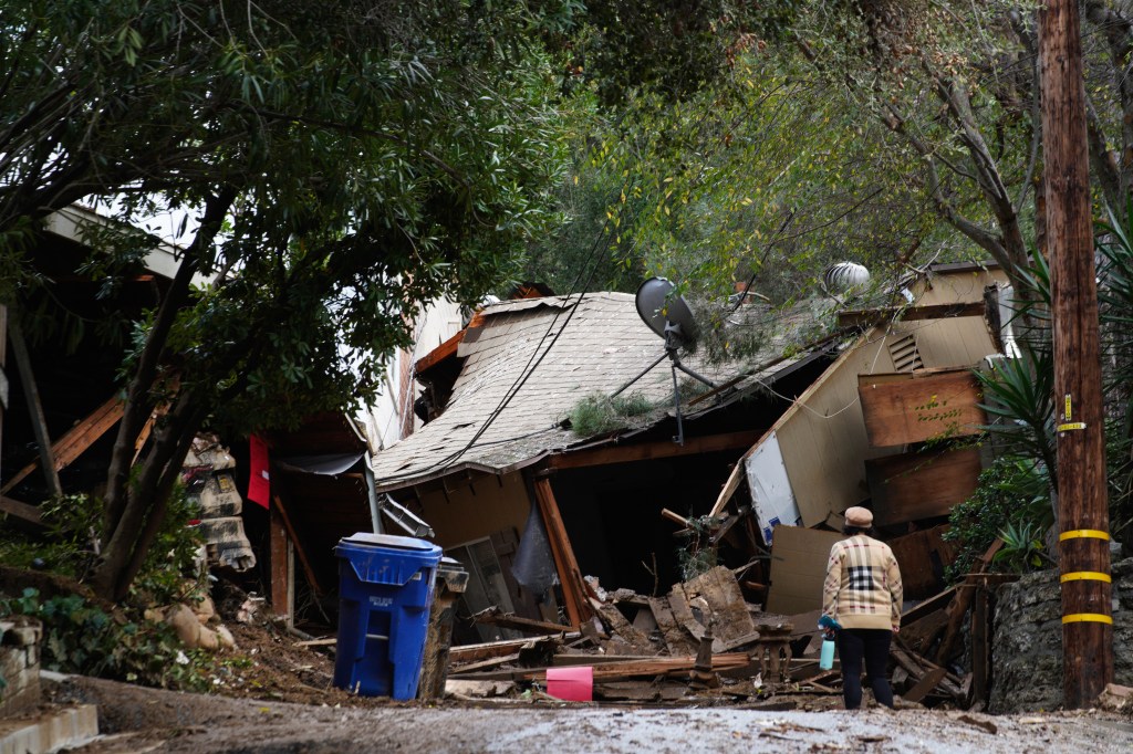
This storm was less intense than the one that just brought destructive wind gusts and torrential rain, but the additional rain was an unwelcome sight for those tasked with the ongoing cleanup efforts in the wake of the multiday atmospheric river.
Even though the storm’s trajectory from the north cut off any tropical moisture connection, keeping it from becoming yet another atmospheric river, unstable air triggered strong thunderstorms that produced a possible tornado in Southern California’s Grover Beach.
“We have had reports of a tornado in Pismo Beach and Grover Beach – unconfirmed but the convective (environment) is primed for severe convection,” the NWS Los Angeles wrote on X Wednesday afternoon, adding later that radar indicated gusts as high as 60 mph in the area.
Photos from Grover Beach show several areas of damage, including toppled trees, strewn debris and some damage to buildings, but there are no reports of any injuries.
The National Weather Service is expected to survey the area Thursday to confirm whether the damage was from a tornado or straight-line thunderstorm wind.
The fast-moving storm system was already pushing most of its rain out into the eastern deserts by Wednesday night with just lingering showers forecast Thursday.
The Los Angeles area generally saw rain totals from 0.20 to 0.40 inches Wednesday on top of the more than 8 inches that fell during the three-day atmospheric river. Santa Ana’s John Wayne Airport set a daily rain record Wednesday with 0.40 inches.
There has also been additional snowfall in the higher elevations of the Sierra Nevada, where some locations picked up several feet of fresh powder over the past few days.
The FOX Forecast Center expects about a foot of additional snow with some locally higher totals from this latest storm system.
The end of the extreme weather is near, though. The FOX Forecast Center said much drier conditions are expected to return to the region on Thursday and last through at least the weekend.
Read the full article Here
