
Ian downgraded to tropical storm as it moves north
Ian was downgraded to a tropical storm on Thursday morning by the National Hurricane Center.
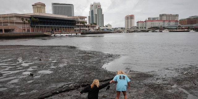
It slammed southwestern Florida as a Category 4 hurricane on Wednesday afternoon, including a 140-mile-per-hour gust recorded in Cape Coral.
In an interview on ABC’s “Good Morning America,” Lee County Sheriff Carmine Marceno said that fatalities in his county are in the “hundreds.”
Forecasters warned that the danger was far from over, including impacts from strong winds and heavy rain.
LIVE UPDATES: HURRICANE IAN ROARS TO CATEGORY 4 STRENGTH, FLORIDA OFFICIALS WARN RESIDENTS TO BE CAUTIOUS
In an update, the center warned that a life-threatening storm surge was expected through Friday along the coasts of northeastern Florida, Georgia and South Carolina.
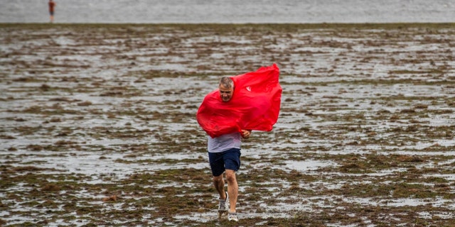
Tropical-storm-force winds are anticipated to spread northward as well, with hurricane conditions possible through Friday along those coasts.
A hurricane watch was in effect.
In addition, life-threatening catastrophic flooding was forecast to continue Thursday across parts of central Florida, with considerable flooding in northern Florida, southeastern Georgia and eastern South Carolina through the end of the week.
Ian was located about 40 miles southeast of Orlando.
Its maximum sustained winds had decreased to near 65 miles per hour, with higher gusts.
FOX WEATHER: WHERE IS IAN HEADED NEXT? DANGEROUS STORM’S IMPACTS WILL BE WIDESPREAD
Tropical-storm-force winds extend outward up to 415 miles from the center of the storm.
It is moving toward the northeast near 8 mph, before a turn toward the north-northeast later Thursday.
It will head toward the north and north-northwest with an increase in forward speed on Friday and Friday night.
The hurricane will go down in history as tied for the fourth-strongest landfalling hurricane in the Sunshine State.
Read the full article Here
