Impactful ice, then heavy snow ahead for Northeast as coast-to-coast winter storm bids adieu
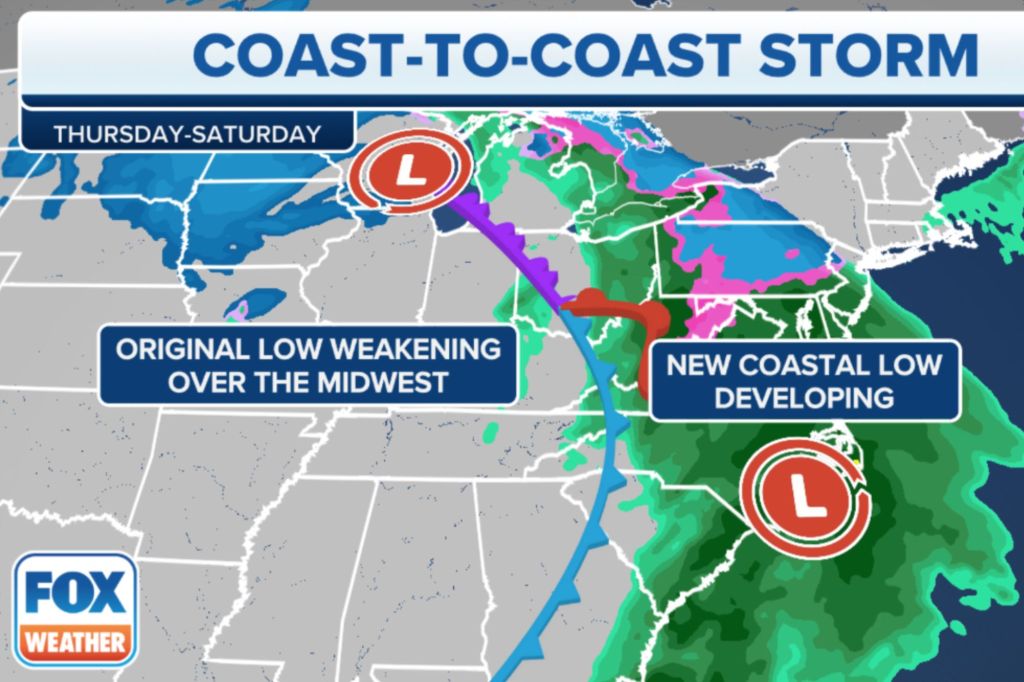
A coast-to-coast winter storm sweeping across the U.S. will approach the Eastern Seaboard on Thursday in what will be the cherry on top of an active week of weather.
The storm system will develop a new area of low pressure that will slide just south of New England, bringing impactful ice and then snow to the interior parts of the Northeast.
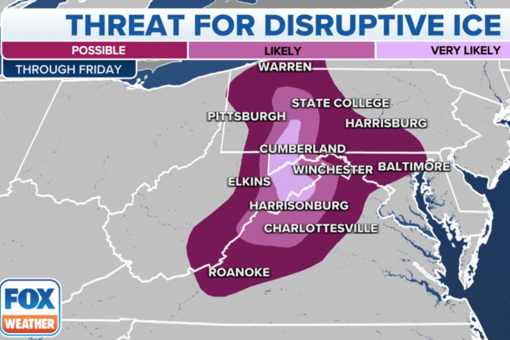
The FOX Forecast Center said the winter storm gets going in the wee hours of Thursday morning. An icy mix of freezing rain and sleet will first break out across the Blue Ridge and Allegheny Mountains of Virginia and West Virginia and then spread up into central Pennsylvania.
The icing will continue through at least midday Thursday, and the buildup will be significant in some areas.
The worst conditions are expected in the mountains of Virginia and West Virginia, where up to three-quarters of an inch of ice is possible. The weight of this much ice will likely bring down many trees and lead to numerous power outages.

Farther north in Pennsylvania, the freezing rain will change over to all snow by mid-afternoon Thursday, which will limit the ice accretion to where it won’t cause too many power outages, but incredibly difficult and dangerous travel conditions are still expected because of the ice and snow.
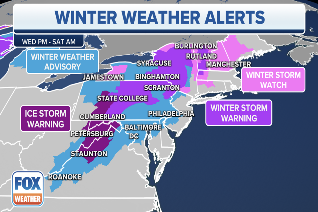
Ice Storm Warnings are in effect where the most disruptive ice is expected, from the Blue Ridge and Allegheny Mountains of Virginia and West Virginia northward to western parts of central Pennsylvania.
Winter Storm Warnings are posted for the rest of central and northeastern Pennsylvania to central and upstate New York and portions of northern New England, where mainly snow is expected.

Winter Weather Advisories have been issued for parts of the Interstate 95 corridor, including Philadelphia, Baltimore and Washington, where a brief wintry mix of snow, sleet and freezing rain could create slick travel Thursday morning before the precipitation changes over to plain rain in the afternoon.
The FOX Forecast Center said the snow will overspread much of central and northeastern Pennsylvania and upstate New York on Thursday afternoon, then expand into Vermont, New Hampshire and western Massachusetts on Thursday night.
Snow will continue all day Friday while also spreading into Maine before it finally winds down on Saturday.

The snowfall amounts will be elevation-dependent, with the higher elevations easily picking up more than a foot of snow from upstate New York to western Maine. Lower elevations will see lower snowfall amounts due to mixing with sleet and freezing rain.
As mentioned earlier, the big cities along the I-95 corridor from Philadelphia to Washington can expect a brief wintry mix Thursday morning before the storm becomes primarily a rain event for them.
Be sure to check back with FOX Weather for updates on both the wintry side and the severe side of this coast-to-coast storm.
Read the full article Here


