
Possible tropical development off Southeast coast by Memorial Day
The FOX Forecast Center is tracking a complex weather scenario off the Eastern Seaboard through the Memorial Day weekend, which could lead to a tropical disturbance developing over the western Atlantic.
Forecast models show a cold front will stall over the Sunshine State during the next week while spin develops in the upper levels of the atmosphere.
The combination of both features will mean a period of heavy rain, rough surf and gusty winds will impact coastal areas.
If development happens over a warm pool of water, it is within the realm of possibility that a weak tropical feature could develop off the Southeast coast.
The FOX Forecast Center said both water temperatures and upper-level winds appear marginal for the potential of slow development.
Ocean temperatures range from the low to mid-70s to nearly 80 degrees Fahrenheit, and upper-level winds don’t appear to be strong enough to completely prevent development.
No matter whether tropical development occurs, some Florida communities are in store for between 3-6″ of rainfall through the next several days.
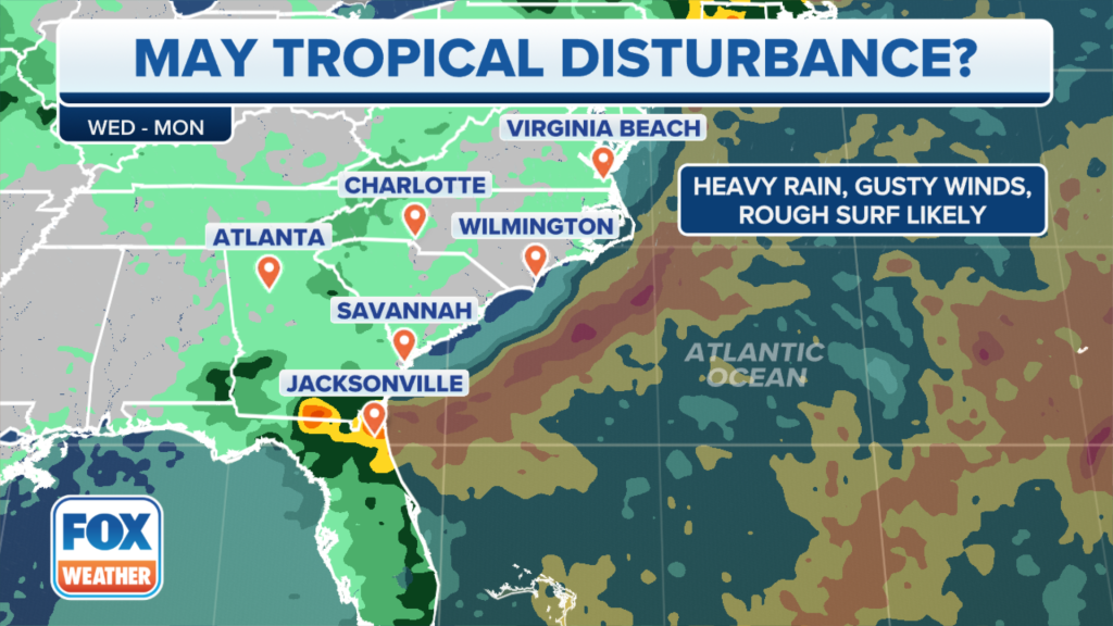
The combination of gusty winds and rough seas is expected to lead to an enhanced threat from rip currents that could stretch from the Carolinas through the Sunshine State into the Memorial Day weekend.
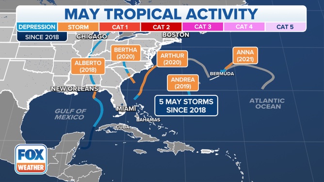
May has history of pre-season development
According to the National Hurricane Center, only 3% of tropical cyclones form outside the official hurricane season, with May being the most popular month for out-of-season development.
A FOX Weather analysis found at least 90 cyclones have formed out of season since the mid-1800s, with nearly half of those occurring during the last month of meteorological spring.

The last cyclone to form during May in the Atlantic basin was Tropical Storm Ana in 2021.
The brief storm developed east of Bermuda but quickly moved northeastward away from the archipelago and out to sea.
Four other storms have formed during the last six years during May, but none strengthened beyond tropical storm status.
Pre-season tropical development doesn’t usually amount to much
If a tropical cyclone does form off the Southeast, it would be the second system of 2023.
A recent reanalysis of a low-pressure system determined that a subtropical storm formed off the mid-Atlantic in January.
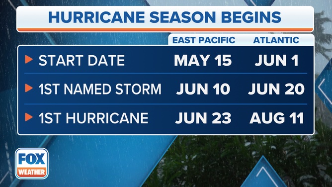
Development during the offseason is rare, and nearly all tropical disturbances before June 1 fail to develop due to a lack of sufficient ingredients.
Meteorologists tracked an area of disturbed weather in the Gulf of Mexico in April that failed to develop into a named entity.
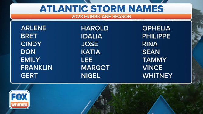
The next cyclone that gains enough organization to be classified as a tropical storm in the Atlantic basin will earn the name Arlene.
The Atlantic’s hurricane season runs from June 1 through November 30.
Read the full article Here
