Tropical Storm Earl forecast to become Atlantic’s first major hurricane
A quiet August in the tropics has morphed into a busier September with two named tropical cyclones roaming the Atlantic Basin: Tropical Storm Earl and Hurricane Danielle.
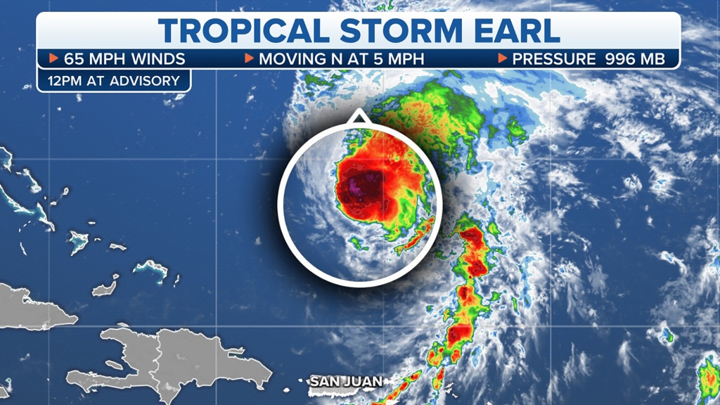
While both systems are currently far from land, Earl’s outer rainbands drenched portions of Puerto Rico and the U.S. Virgin Islands over the Labor Day weekend, and now it’s moving northward in the general direction of Bermuda.
As of midday Tuesday, Tropical Storm Earl was centered nearly 600 miles south of Bermuda with maximum sustained winds estimated at 65 mph.
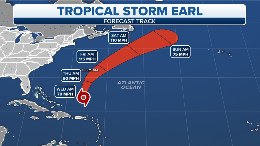
Earl is expected to move slowly toward the north or north-northeast through Wednesday before gaining forward speed and turning more northeasterly by Thursday.
Strengthening is forecast, and Earl is expected to become a hurricane within the next couple of days. Earl will likely make its closest pass to Bermuda from late Thursday into early Friday as a Category 1 or 2 hurricane.
However, any potential rain and wind impacts in the archipelago remain uncertain and are dependent upon the exact track of Earl.
Earl is not expected to bring any direct impacts to the U.S., as it will likely head out into the open waters of the North Atlantic this weekend after passing near Bermuda late in the week. However, the storm will bring an increased threat of rip currents at beaches along the Eastern Seaboard for the next few days.


Current predictions indicate that Earl will become the Atlantic’s first major hurricane of the season by Friday after it pulls away from Bermuda. A major hurricane is one that reaches Category 3 or higher intensity on the Saffir-Simpson Hurricane Wind Scale.
Hurricane Danielle spins in the open North Atlantic
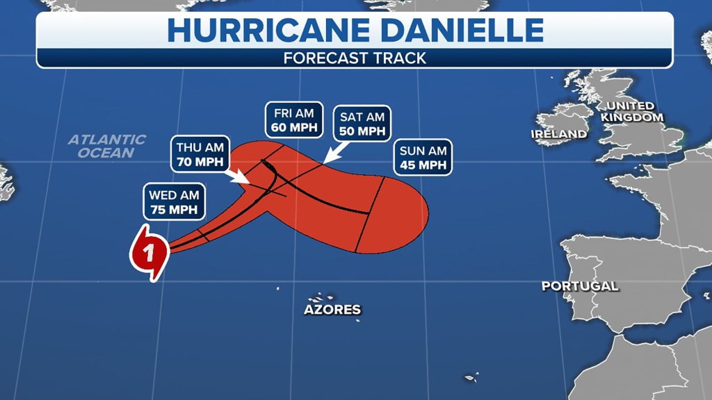
Danielle became the first Atlantic hurricane of the season last Friday after August finished with no named storms for the first time in decades. But Danielle is harmlessly spinning over the open waters of the North Atlantic and is centered more than 800 miles west-northwest of the Azores.
After weakening to a tropical storm for most of Saturday, Danielle strengthened again into a Category 1 hurricane late Saturday evening and has held onto that status into Tuesday.

Hurricane Danielle continues to slowly move off to the east-northeast, in the general direction of northern Europe. Danielle is expected to gradually weaken over the next several days as it stays far away from land.
Two other areas to watch for development
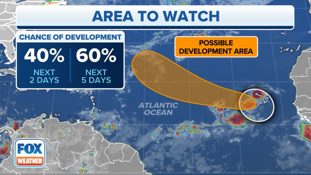
In the eastern tropical Atlantic, an area of disorganized showers and thunderstorms stretches from the Cabo Verde Islands southwestward for several hundred miles in association with a broad area of low pressure.
According to the FOX Forecast Center, environmental conditions are conducive for some development of this system, and a tropical depression could form in a few days as it moves west to west-northwestward at 15 to 20 mph over the eastern and central tropical Atlantic. However, upper-level winds are likely to become less conducive for development late in the week.

The National Hurricane Center currently gives the system a medium chance of development in the next five days.
Additionally, a tropical disturbance over western Africa is forecast to emerge offshore into the eastern tropical Atlantic in the next day or two.
According to the FOX Forecast Center, environmental conditions generally appear conducive for some slow development of this disturbance as it moves west-northwestward over the eastern tropical Atlantic.
The NHC currently gives the tropical disturbance a low chance of development in the next five days, but those odds could increase beyond the five-day outlook, so be sure to check back for updates.
Read the full article Here


