Weekend storms, flood threats expected in Northeast
The record heat and sunshine has been abruptly replaced by a weekend of storms, triggering a third day of severe weather threats in the mid-Atlantic and Northeast and an increasing threat of flooding near the Appalachians.
A slow-moving front trudging to the east has tapped into abundant moisture, courtesy of the lingering effects of the hot and humid airmass setting records in the region for several days this week.
Severe thunderstorms with wind gusts over 50-70 mph slammed the Northeast Friday leaving tens of thousands without power in Massachusetts and New York and generating more than 200 storm reports for the NWS — a vast majority reporting trees and/or power lines toppled in the ferocious gusts.
Andover, Massachusetts was hit hard by severe thunderstorms and town officials report several major and secondary roads remain closed due to downed trees and power lines. Much of the city remained without power as of midday Saturday.
While showers and thunderstorms return to the forecast this weekend, the severe threat isn’t quite as expansive for Saturday.
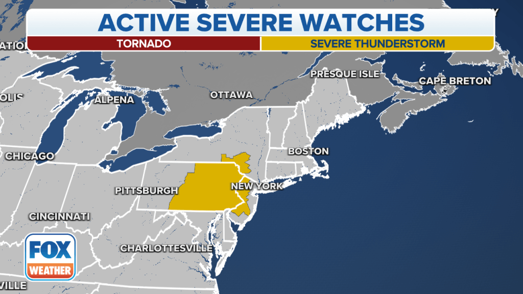
NOAA’s Storm Prediction Center does have a Level 2 of 5 risk for severe weather in eastern Pennsylvania — though Philadelphia this time is just outside the zone – but the risk does cover northwestern New Jersey and a sliver of southern New York.
Due to the threat a Severe Thunderstorm Watch has been issued for Philadelphia, Washington, D.C. and Baltimore through the evening.
Damaging wind gusts again of 50-60 mph are the greatest threat from severe thunderstorms, in addition to bursts of heavy rain and frequent lightning.

Flood Watches in effect for parts of the mid-Atlantic
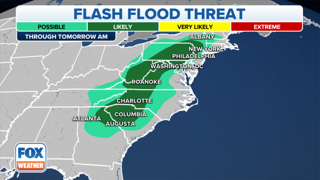
Farther south, it’s not wind or hail, but the storms’ heavy rains that are of concern.
Thunderstorms along and east of the Appalachians could see rainfall rates of 2-4 inches per hour, and repeated batches of storms could lead to flash flooding.
Flood Watches are in effect through late Saturday from southern West Virginia, through western Virginia and into western North Carolina, including Roanoke, Virginia and Charlotte, North Carolina.

Sunday remains wet
Sunday doesn’t look much, if any drier in the mid-Atlantic or Northeast with rounds of showers and thunderstorms expected to continue.
The severe weather threat wanes for Sunday but another quarter to half of rain is likely to keep skies gray and puddles growing.
Showers hold in the forecast Monday and at times into the middle of next week before drier weather gives residents a chance to wring out later next week
Read the full article Here


